The is a two-part post – in case you missed Part I, you can check it out here.
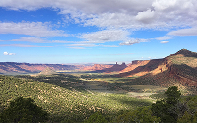
Day 3: Dewey Bridge is named for the old bridge that crosses the Colorado River along Utah Highway 128 (which actually burned down a few years ago). If you’ve never driven 128 from Cisco to Moab, you need to do this drive! It’s what you imagine when you think of the desert West: dramatic cliffs, narrow spires and towers, tall buttes and shelves. It’s mysterious and weird, and you feel like you’re on mars.
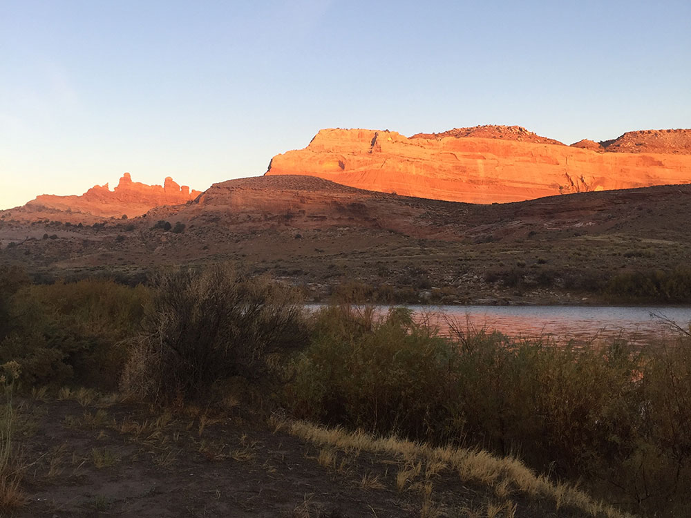
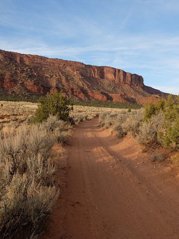
We woke up before the sun, but shortly after the red rocks started lighting up around us.
The bikers who we camped next to were from Nebraska and had decided to do the trip on fat bikes. Between their bikes and gear, they each had nearly 90 lbs on them (side note: I noticed one of the guys had a hairbrush, so who knows what else they had that they may not have needed)! They said that the trail had been taking them twice as long as the guidebook had suggested. They had decided to bail and finish the trip on the road. Neither Brian or I could imagine trying to haul 90 lbs worth of gear over some of the boulders we encountered on Day 1. We didn’t blame them! Leapfrog car camping may not have been the best strategy, but it was sure better than riding fat bikes with all our gear!
We spent a long time determining how best to tackle the next section. Technically if we wanted to ride the entire trail, we’d need to backtrack a little bit and ride from Fish Ford to Dewey Bridge. Though it was only a 12-mile section, it was going to add at least an hour of driving in the morning, and another hour in the evening. The next logical place to camp was at Onion Creek, which was not along a main road like Dewey Bridge, so we’d either be driving on backcountry roads or biking them to access the next camp. We knew it would be a long day anyway, so we decided to skip the Fish Ford to Dewey Bridge section.
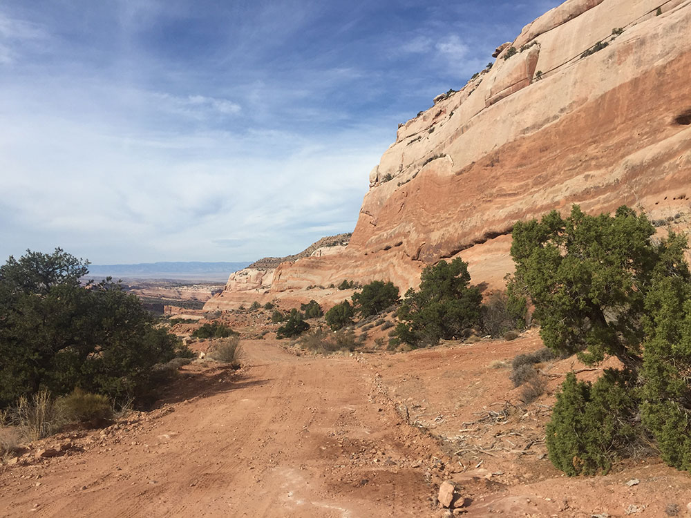
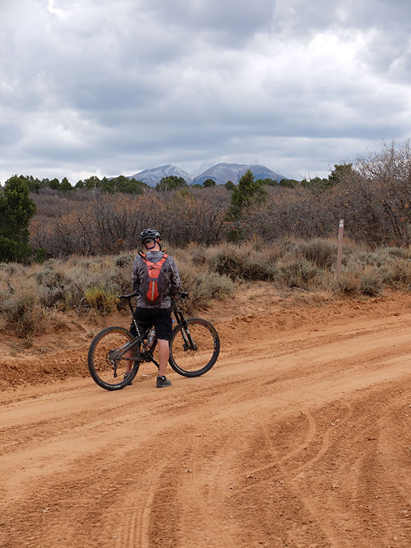
After dropping a car at Onion Creek and claiming a campsite, we started biking at Dewey Bridge. The first few miles followed a dirt road and we enjoyed the gentle uphill while taking in the gorgeous Entrada bluffs around us.
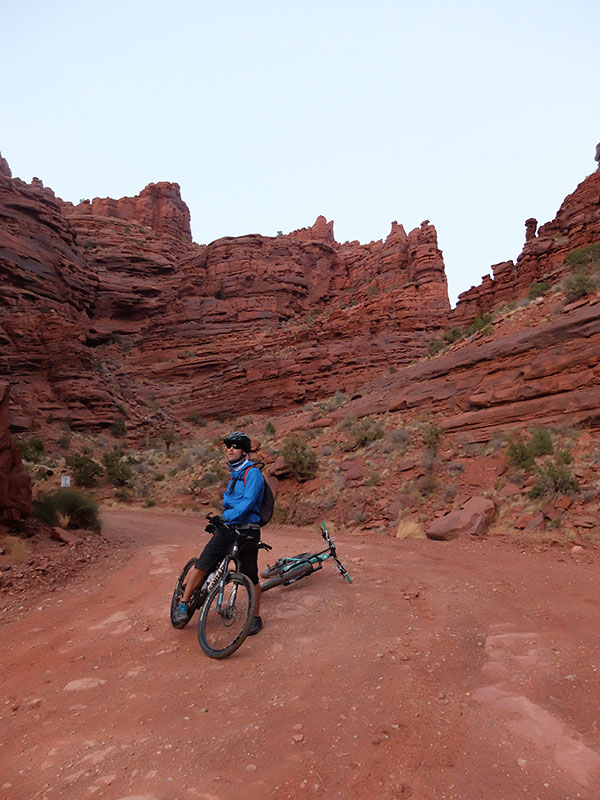
After a few miles we dropped into a steep canyon on an old jeep trail, which was more like single track scattered with bowling ball sized rocks.
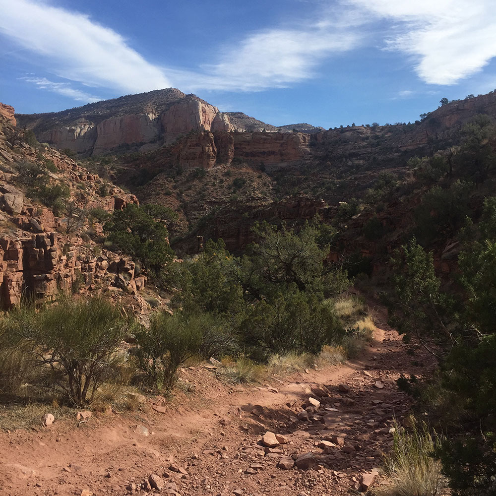

Soon enough we reached the bottom of the canyon, which was speckled with a few brilliant cottonwoods. We headed right back up the steep other side, which was even rockier than the downhill. The guidebook says this is ridable, but we both wondered if the book might be a little out of date (or cah-razy!). I bet some super athlete can manage it, but there was just no way either of us could conquer it.
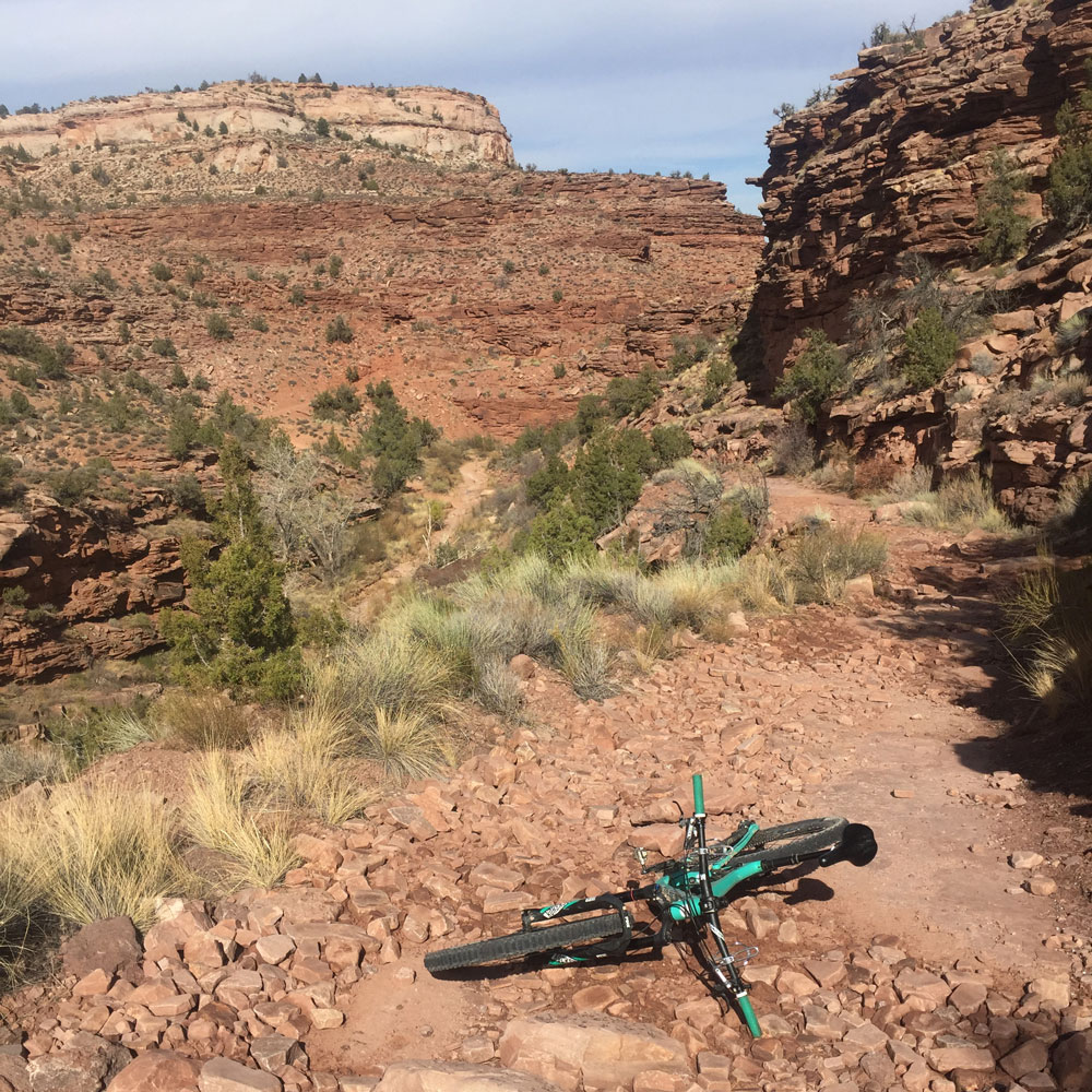
This canyon was challenging, but it didn’t take terribly long, and it was definitely one of the more interesting spurs of biking I have ever done. And soon enough we were eating lunch, surrounded by gorgeous bluffs again.
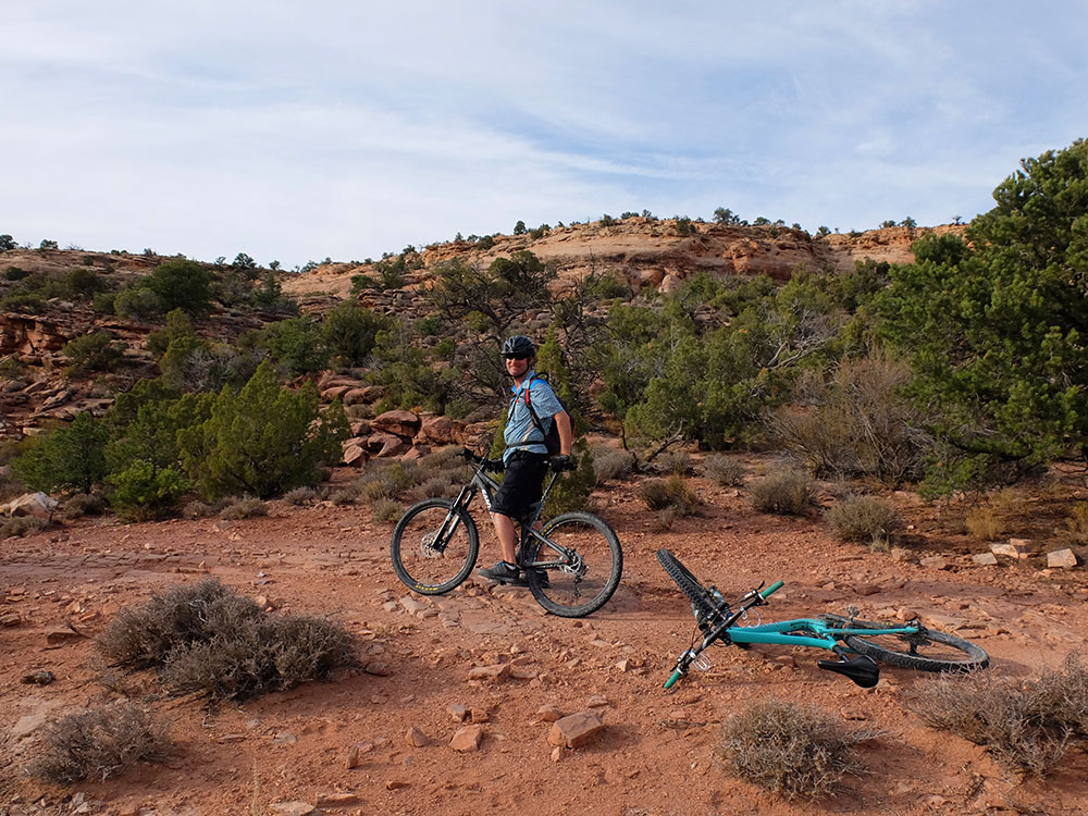
The next several miles were more sharply inclined uphill. Despite being on a road, it was rocky and we sometimes had to get off our bikes for stretches. I finally broke down and had to dig out my earbuds and listen to some music to get myself up the hill. And not even my normal bluegrass / jam band playlists would do the trick – I had to switch to something with a real beat – Black Eyed Peas, Lady Gaga, and all of the pop stuff I don’t listen to very often. It did the trick though (and I probably burned a few extra calories by dancing on my bike!).
Eventually we dropped down into a new canyon, but I was starting to feel so whooped that I was nervous about really screaming down it. We were truly far into the backcountry and I could not afford to injure myself (not that I can anywhere, for that matter). I swallowed my pride and walked a few sections, while Brian cleared most of the obstacles.
We saw some amazing scenery along the way, which kept me going after 5 difficult hours.

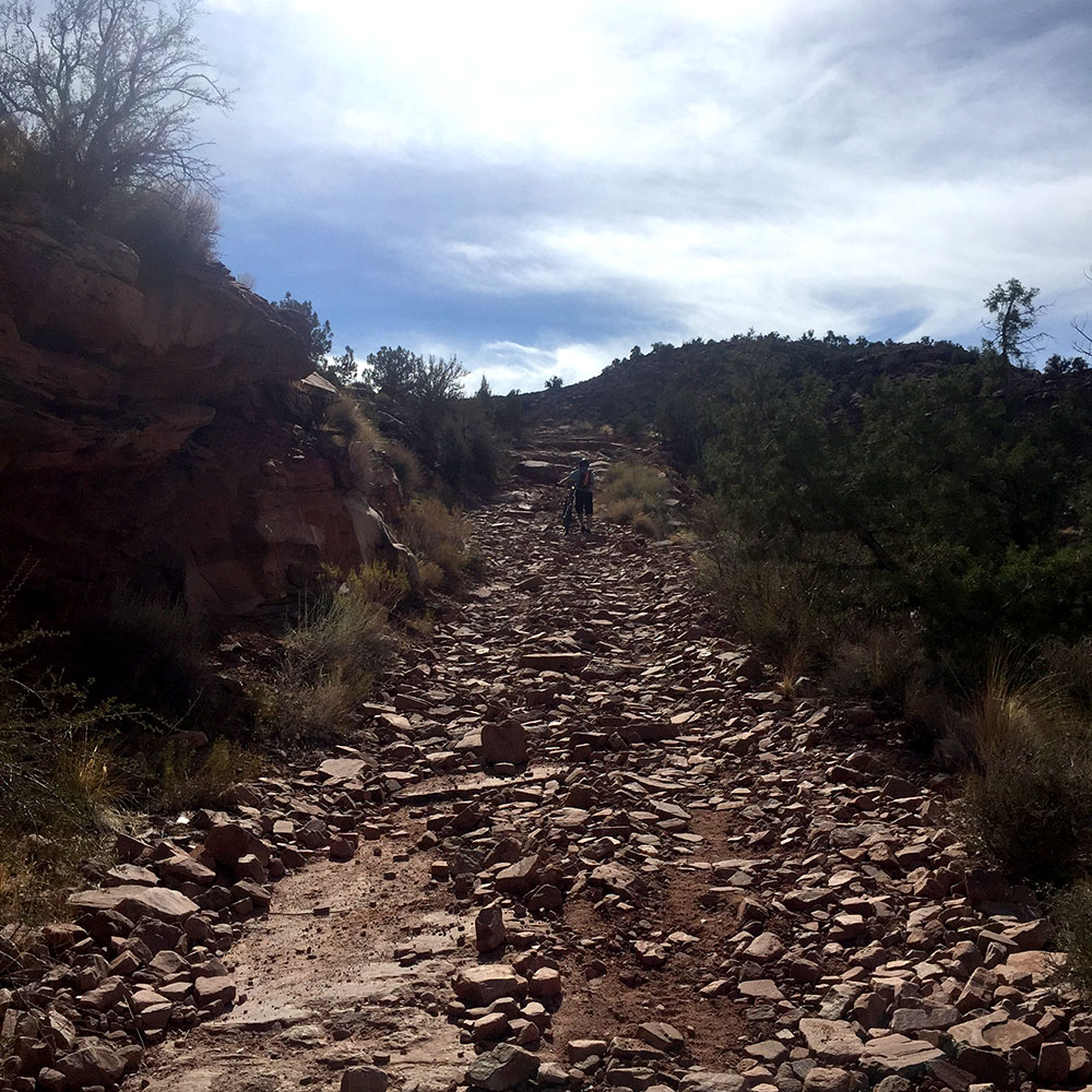
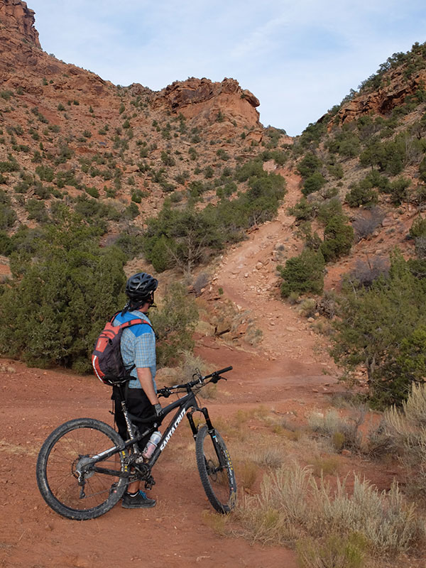
We finally reached Rose Garden Hill, the infamous hill on this section of trail. I don’t know how anyone in their right mind could ever ride this! It consisted of boulders ranging in size from a basketball to car, and there was no clear path to avoid any of it. It took us about 20 minutes to walk down it.
We climbed back out on the other side of the canyon, testing what little energy we had left. We were racing the sun at this point and I was feeling nervous about making it to our next camp before dark. I have to admit my morale was definitely suffering – the book had predicted this stretch would take 3 hours, and we were almost up to 6! After an apple and some chocolate, I managed to push on to Fisher Valley, which is technically the end of this section.
Fisher Valley was the reward I needed to keep going. We were truly in the middle of nowhere, and the setting sun turned the savannah-like grasses and sage brush a wispy golden color, surrounded by more tall red cliffs.

We could’ve camped here, but in the morning we had chosen a campsite along Highway 128, another 9 miles down the dirt road. We had figured one-way downhill on our bikes would be faster than two ways in a car on an unfamiliar backcountry road.
I was exhausted, but riding down Onion Creek Road at dusk was something I’ll never forget. The road winds through an incredible orange canyon, filled with strange and unique rock formations and hoodoos everywhere. And between Fisher Valley and 128, you cross the same creek 26 times! My only regret was not having my “nice” camera. The iPhone just doesn’t capture great photos in the dwindling evening light. I barely took any because the light was fading so fast.
After 7 hours, we finally made it to our camp, a bit wet and cold from the stream crossings, but both in one piece. It was just about dark, so we quickly retrieved the car at Dewey Bridge, and hurried back to heat up chili and tortillas for dinner. Oh yes, and we had beer, wine, and brownies. YUM!
Day 4: After our third day on the trail, we were trusting our trusty Bikerpelli guide book much less than the previous two days. I’m glad we had it, but I was starting to feel nervous that days 4 and 5 might also take twice as long as predicted.
We got an early start and shuttled a car way up into the La Sal Mountains, then headed back to Onion Creek, this time driving back to the trail access point. I was feeling intimidated, worried that we were going to run into another morale-busting day. Plus, the sky was overcast and we were increasing our altitude with potential for rain and/or snow.
Fortunately, despite being rated just slightly technically easier than day 3, day 4 was significantly easier. Yes, we did something like 3,500 feet of climbing, but it was fairly slow and steady going without too many obstacles. My Subaru could’ve driven the whole thing at 30 mph or more, if that tells you how smooth it was.
And the views didn’t suck:
This is looking back over Fisher Valley, where we started for the day.
We got hit with a few cold rain drops, but for the most part finished the day unscathed. Easy breezy compared to the day before!
We finished at the Rock Castle campground and then headed back to Onion Creek to pick up the other car and camp at the same campground as the previous night.
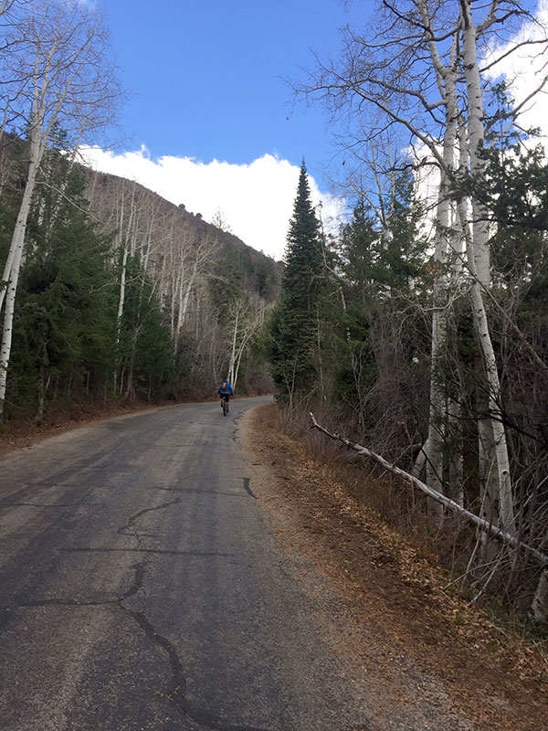
Day 5: The final day was a fun combination of paved road and singletrack. After breakfast we shuttled a car to the Negro Bill trailhead parking lot near Moab. We spent the first two hours pedaling 2,000 feet up into the La Sals, allowing us to get closer to this mountain range than I’ve ever been.
I have always seen the La Sal Mountain Range from dozens of miles away in Moab over the many, many times I’ve been there. I’ve always had this instinctual urge to go explore them, almost like they were calling me. I think knowing that they are so remote, and that it’s not a very popular activity to go climb or ski them (like pretty much all mountains in central Colorado), has made them alluring to me.
Riding our bikes up a paved road, skirting their flanks, wasn’t the La Sal expedition I’d always dreamed of, but at least it got me up close and personal with them. We rode through high alpine meadows and aspen groves, and it just made me want to go back and explore more.

Not to mention, the views looking back down into Castle Valley were out of this world:

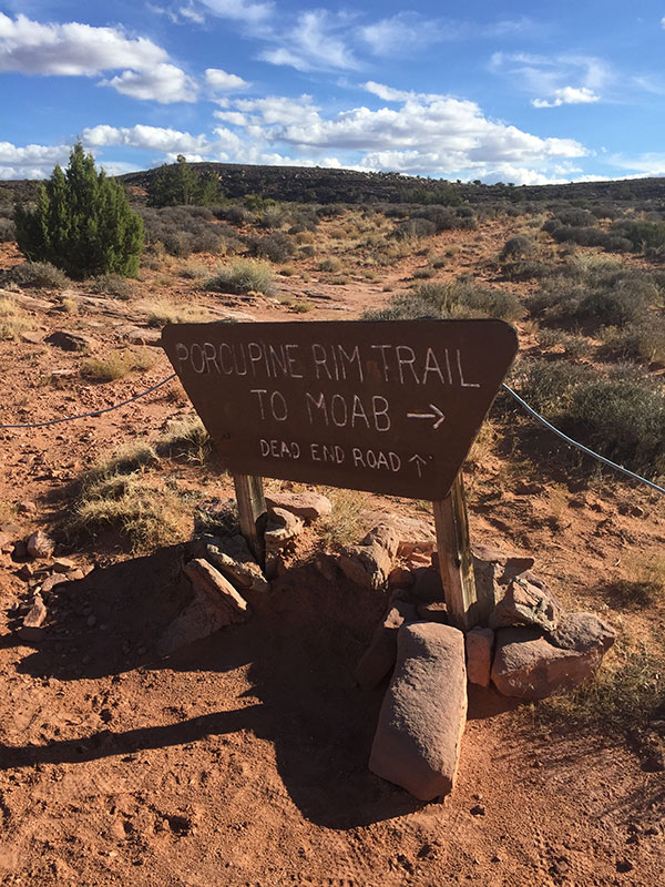
At the top of the climb we reached the UPS Trail, which connects to the LPS Trail and then the main Porcupine Rim Trail. The “normal” Kokopelli Trail takes you down the Sand Flats Road, but we had planned to take the alternative route of the Porcupine Rim instead.
In 2012, we rode the Porcupine Rim Trail, I crashed big time, and hairline fractured my femur. I had always wanted to go back and finish the trail, but until now I hadn’t had the chance. I was a bit nervous, but I told myself I’d walk any extra technical parts and take my time.
At the top of the trail there was a very large group of bikers (30+) with downhill-style bikes. It was a sharp contrast to the rest of the trail, where we had seen maybe collectively 10 riders in four days. I knew they’d be bombing the trail and I let myself get a bit intimidated. However, I was able to push through my anxiety and eventually the group all passed us.
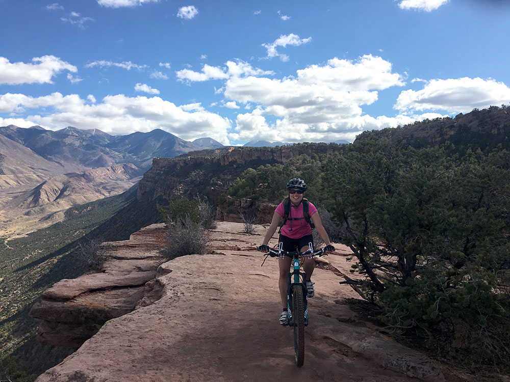
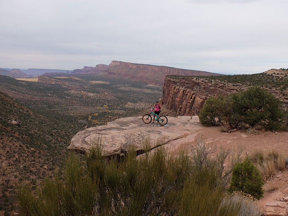
We rode out of the clouds and the sun felt amazing. From a scenery standpoint, this is one of the most unique and breathtaking rides I’ve ever done.
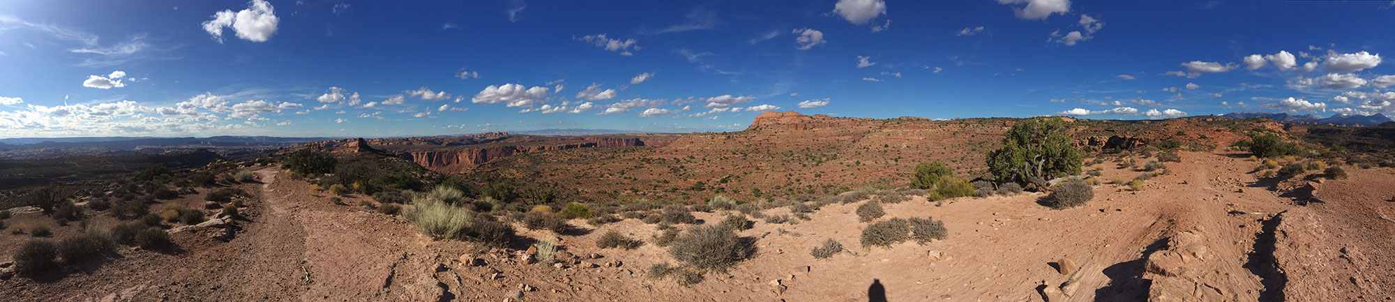 Click to enlarge panoramic photo!
Obligatory picture of the trail sign to prove I did it:
I can now say that if I never ride the Porcupine Rim Trail again, I won’t be overly upset. It’s definitely a downhill-style trail and very technical for many stretches. I spent a lot of time getting on and off my bike. Brian said he thought he could’ve finished an hour faster if I hadn’t been with him, and it’s probably true. I’m just a smooth singletrack kinda gal!
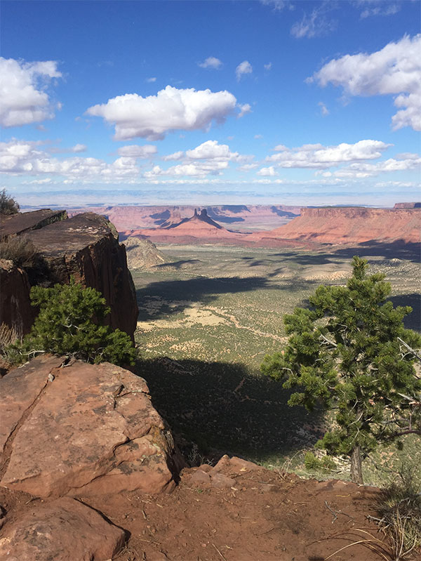
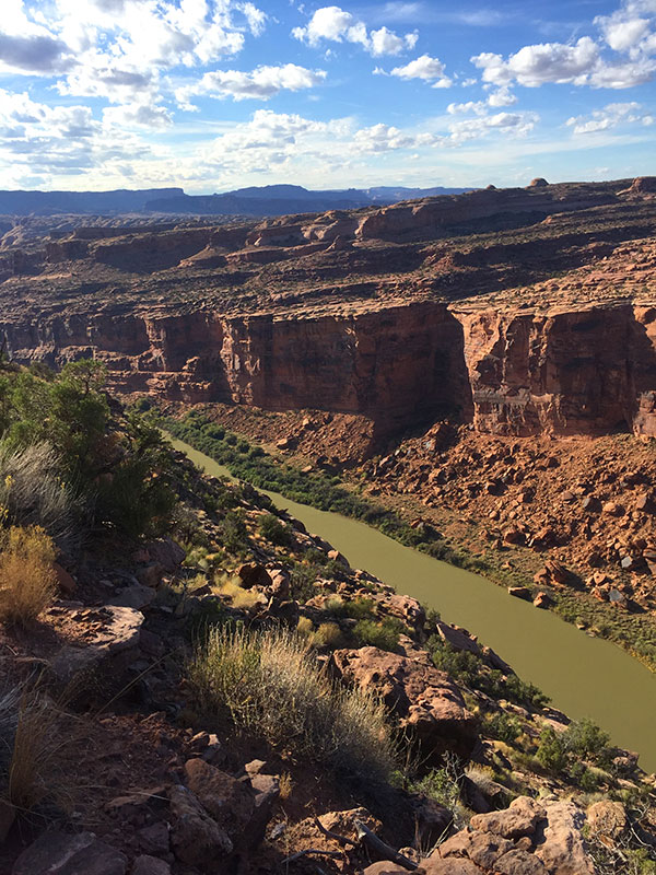
Here was the last stretch of the trail, high above the Colorado River (again!) and Highway 128.
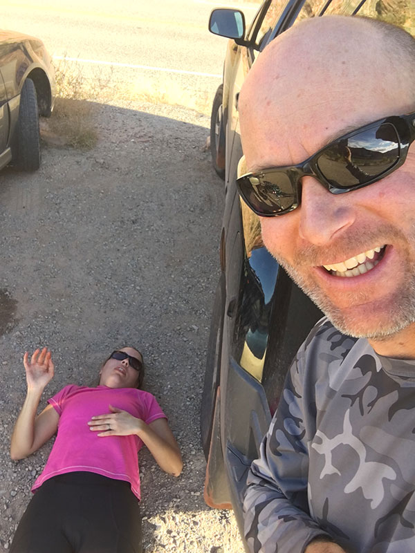
Six hours from when we left Rock Castle, we finally made it to the Negro Bill Canyon parking lot. I was pooped!
It’s a little hard to believe we rode 142 miles (give or take with our shortcuts and additions) in 5 days! This might not seem like a lot to some, but before this, my longest mountain bike ride came in at about 35 miles.
We felt accomplished, and to celebrate, we headed into Moab to get a burger and a beer at the brewery (and an appetizer, salad, and fries, too!). Man, did they taste good!
Biking the Kokopelli Trail was definitely an adventure to remember. It was one of the most physically demanding things I’ve ever done. I loved the solitude of being alone in the desert, miles and miles from another human being. We both were thankful we did this in late October, lessening the chance for crowds and increasing the odds for having the wilderness all to ourselves.
All that being said, I’m ok with waiting a while to do another multi-day, long-mileage bike trip. I was definitely overly ready for a shower and a real bed by the time we were finished! My body was ready for a few days of rest, too. So at least till the snow flies this winter, I’ll be finishing out my fall with short bike rides and some really good memories.
Trackbacks/Pingbacks